By: Mike Lovegreen
USC Stream Coordinator
The USC has a long history of assessing the watershed needs in the Region and developing a strategic plan to address those needs. This really is no surprise since the USC is made up of the Soil and Water Conservation Districts/Conservation Districts. One of the primary roles of the Districts is to identify those specific needs in their Counties, develop plans to meet those needs and mobilize resources to address them.
In the last several years, the USC Stream Team has helped focus on individual watersheds through several initiatives to help Districts do a finer job of identifying needs. Working through various funding resources as well as sharing training and organizational assistance, the USC has worked to assist in over a dozen watersheds assessments in the last few years. While all the studies have varied slightly according to the local capacity and resources available, they all have
followed similar approaches that include:
- Developing Background Studies – an inventory of the physical, geological, social and economic elements that have
influenced the evolution of the watershed and it’s response to the environment it exists in. Historic projects and impacts on the stability of watershed development often provide clues to current challenges. - A Physical Assessment of the watershed – this includes an on the ground inventory of both needs and opportunities to address current and projected challenges.
- A “Triage” List of Potential Projects – which includes consideration of different solutions to identified needs along with an estimate of costs in dollars, technical resources and educational needs
- A Priority List – that considers both the realistic funding projection and the community needs.
Some example of products and projects that the USC, in particular the Stream Team has engaged in the recent years includes:
A Stream Corridor Assessment Guide and training program. This guide recognizes that stream corridor functions are integrated and impact on each other. These stream corridor components include the channels, banks, riparian areas, floodplains and upland impacts. Symptoms of stream channel instability and increased flooding is often related to the dysfunction of one or more of these corridor elements. The guide provides a method of assessing each of these components and direction as to next steps. The guide has recently been added to the NY Agricultural Environmental Management Program.
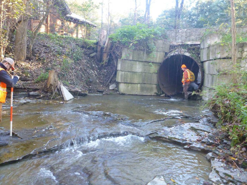
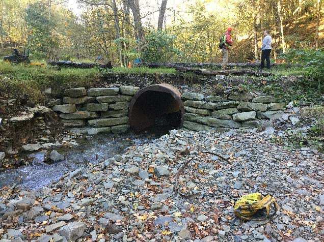
The I-4 Program funded through the National Fish and Wildlife Foundation. Under this funding through the USC, 7 watershed in 4 USC Counties organized and conducted watershed assessments utilizing the approach outlined above. Over 4,000 sites were documented and assessed and 37 associated studies were conducted.
The NY Rising Projects funded an additional 6 watershed assessments in Tioga and Broome Counties, again following the assessment outline above, utilizing the assistance of a consulting firm.
The Regional Susquehanna River Initiative project was conceptualized through the New York Rising Community Reconstruction (NYRCR) Tioga community planning process following widespread flood devastation along the Susquehanna River and its tributaries in 2011. The area was affected by both Tropical Storm Irene and, shortly after, Tropical Storm Lee which delivered intense rainfall onto the already saturated watershed. Costly impacts included loss and damage of homes and businesses, loss and damage of utility infrastructure, road closures and washouts, and stream bank erosion affecting agricultural productivity.
The Tioga County Soil and Water Conservation District (TCSWCD) secured U.S Department of Housing and Urban Development (HUD) Community Development Block Grant‐Disaster Recover (CDBG‐DR) funding through the NY Rising Community Reconstruction (NYRCR) Program of the New York State Governor’s Office of Storm Recovery (GOSR). Its primary focus is to identify sustainable flood mitigation measures for seven priority watersheds within the Tioga and Broome communities.
Project Details
DATE:
January 2018 through December 2020
PROJECT PARTNERS:
Broome County Soil & Water Conservation District
Tioga County Soil & Water Conservation District
WATERSHEDS:
Watersheds in Tioga are: Apalachin, Huntington and Wappasening
Watershed in Broome are: Brixius, Fuller Hollow and Chamberlain
Project Gallery